The Unique Maps Co.
Australia Topographic 3D Relief Map
Australia Topographic 3D Relief Map
Couldn't load pickup availability
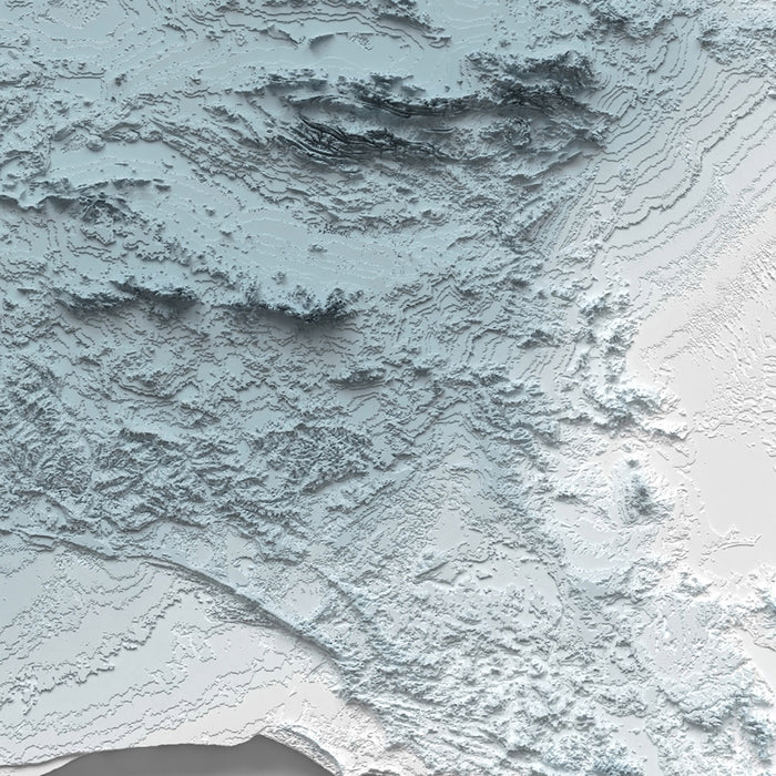
This is a minimalist topographical relief map of Australia, created by The Unique Maps Co. and enhanced with our trademarked Unique 3D process. There are no labels, no roads, and no towns — just the continent’s landforms expressed through sculpted light and shadow. As illumination rakes across the surface, high peaks catch a crisp gleam while low basins and river plains fall into soft shade, revealing an Australia you can almost feel with your eyes.
Along the eastern seaboard the Great Dividing Range rises clearly, a long, faulted spine that runs from the tropical north down to Victoria. You can trace the steep Great Escarpment as it breaks sharply toward the coastal plains, then follow the high country through the New England Tablelands and the Blue Mountains to the Australian Alps. Here the Snowy Mountains stand out with bold relief, their summits — including the roof of the continent around Mount Kosciuszko — picked out by bright highlights and deep, narrow shadows along ridges and cirques. North of there, uplands like the Atherton Tableland and ranges near Cairns show as a knotted cluster of elevated forms pressing close to the coast.
Just inland, the wide sweep of the Murray–Darling Basin reclines as one of the broadest lowlands on the map. Its meandering river corridors carve gentle depressions across the Riverina and into northwestern New South Wales and southern Queensland. Subtle shading distinguishes these fertile plains from the surrounding uplands, with the Monaro and Southern Tablelands stepping down into Victoria’s lower country. Westward, the Grampians (Gariwerd) and the Otway and Strzelecki Ranges lift out of the Victorian lowlands in crisp relief, their serrated skylines casting tapered shadows that point the way toward South Australia’s rising ground.
The heart of the continent spreads out as the immense Western Plateau and the Outback’s tablelands. Here, the light grazes across vast, ancient surfaces: the Tanami and Gibson country, the Great Sandy and Great Victoria Deserts, and the famous dune fields of the Simpson and Strzelecki. Long, parallel ridges throw evenly spaced shadows, while low mesas and breakaways punctuate otherwise even terrain. In central Australia, the MacDonnell Ranges and nearby folded belts appear as sinuous, repeating ribs around Alice Springs, their alternating light-and-dark bands making the region’s ruggedness unmistakable. To the south, the saucer-like depression of the Lake Eyre (Kati Thanda) Basin lies in a soft hollow — a quiet, shaded center that hints at the continent’s lowest point.
Western Australia’s topography is etched with contrasts that read beautifully in relief. The Pilbara and Hamersley Ranges are scored with deep gorges and high ironstone plateaus, their sharp escarpments catching stark highlights. Farther south, the Yilgarn’s ancient uplands ease down toward the coastal plain, checked by the clean line of the Darling Scarp behind Perth. In the far southwest, the Stirling Range pops up as an isolated mountain knot, while to the south the Nullarbor Plain runs flat and unwavering to the Great Australian Bight. Along that edge, a hard, narrow shadow marks the line of sea cliffs — a razor-straight frontier between plateau and ocean that is unmistakable even without labels.
To the tropical north, the map shows the dissected plateaus of the Kimberley, a labyrinth of ridges, domes, and gorges rendered in tight, intricate shading. Crossing the Top End, the Arnhem Land Plateau and the escarpments that fringe Kakadu present a bold step down to floodplains and mangrove-fringed lowlands. The Gulf Country’s broad, gently folded terrain flows west to east with a soft undulation, while the Barkly Tableland and the Channel Country display broad, shallow swales where ephemeral rivers spread into braided lacework. Across Cape York Peninsula, a subdued spine separates the peninsula’s two coasts, with modest uplands and low divides guiding drainage either to the Gulf of Carpentaria or toward the Coral Sea.
Just off the southern margin, Tasmania stands as a compact world of relief. The Central Highlands and western mountains rise abruptly, their serrated ridges and glacial valleys carved into high-contrast relief. Peaks around Cradle Mountain and Mount Ossa gleam along their crests while deep valleys and lake-strewn plateaus fall into pocketed shade. Eastward, the terrain declines into gentler hills and broader valleys, a tonal easing that makes the island’s varied topography instantly legible.
For those who call Australia home, who have crossed it by road or rail, or who hold a memory of a favorite coastline, range, or desert, this minimalist relief invites instant recognition. Without a single label, the continent’s story unfolds through light and shadow — from coastal escarpments and snowy summits to river basins, plateaus, deserts, and island ranges — a tactile portrait ready to hang on any wall.
Please note that our Unique 3D maps look remarkably 3D, particularly when framed, but they are 2D prints on paper (or canvas).
About our Unique 3D Topographic Relief Maps
These aren’t just maps — they’re landscapes, sculpted with light and shadow.
Our shaded relief prints use ultra high resolution topographic data and a secret 3D rendering process to create the illusion of raised terrain — like the mountains are about to lift right off the page. No labels, no borders, no distractions. Just the raw shape of the land, brought to life in a clean, modern style.
They’re designed to feel timeless. Bold enough to be a centrepiece, subtle enough to blend in. A perfect gift for map lovers, mountain wanderers, or anyone who finds beauty in the shape of the Earth.
Learn more about our Unique 3D process.
And of course, like any of our other maps, you can personalise this topographical map as well. Why not mark your favourite peaks, or the routes of your favourite hikes and cycle rides?
More Product Info
If you're not sure what size to order, or you're looking for a custom order of some kind – a different size, a different colour, a special frame – then please contact me. I usually respond within a few minutes.
You can see an example of my map personalisation service in the fifth image. Zoom in and take a look. My personalised maps are always very well received. Take a look at more examples of personalisation.
You can also choose to age your map to make it look older. This is popular amongst my customers who want their artwork to look like an older, antique print. You can see an example of ageing in the sixth product image, or go ahead and check out lots of examples of other aged artwork.
The model in the listing images is holding the 16x20in (40x50cm) version of this map.
I can print and frame this beautiful topographical 3D map at sizes up to 3 metres (10ft). If you are looking for a size or framing option that isn't available online, please get in touch.
This map is available as a giclée print on acid free archival matte paper, or you can buy it framed. My standard frames come in six colours (black, dark brown, dark grey, antique gold, oak and white), and custom framing is available for an additional charge. My frames are glazed with super-clear museum-grade acrylic (perspex/acrylite), which is significantly less reflective than glass, safer, and will always arrive in perfect condition.
Share