The Unique Maps Co.
Large Masterpiece World Map by Danckerts, 1696: Mythical Lands, Decorative Border
Large Masterpiece World Map by Danckerts, 1696: Mythical Lands, Decorative Border
Couldn't load pickup availability
Crafted by the esteemed Cornelis I Danckerts in 1696, the "Nova Totius Terrarum Orbis Tabula" is a captivating testament to the age of exploration and cartographic artistry. This exceptionally rare map, a masterpiece of its time, reflects the rich legacy of the Danckerts family, renowned for their contributions to mapmaking in Amsterdam. With its vibrant original colors, this map not only charts the known world but also captures the imagination with its speculative geography, offering a glimpse into the adventurous spirit of the 17th century.
The map is adorned with a striking double-hemisphere projection, complemented by two polar insets that reveal the mysteries of the Earth's extremities. It is a vivid portrayal of the world as it was understood, and often misunderstood, during a time when explorers were driven by the allure of uncharted territories. The depiction of California as an island and the mythical Strait of Anian are intriguing reminders of the era's geographical misconceptions and the relentless quest for new passages and lands.
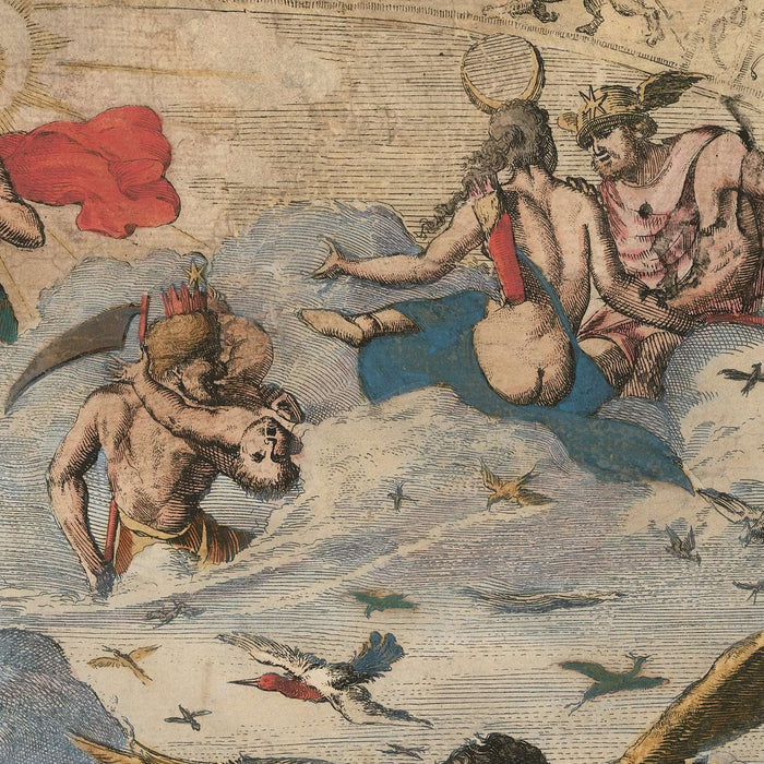
Danckerts' work is further distinguished by its decorative borders, which are as informative as they are beautiful. Each corner of the map represents one of the classical elements: fire, air, water, and earth. These allegorical illustrations add a layer of depth and artistry, transforming the map into a visual narrative that extends beyond mere geography. The top left corner, with its depiction of fire, evokes the explosive power of discovery, while the pastoral scene representing earth grounds the map in the reality of the known world.
This map also serves as a historical document, capturing the political and cultural context of its time. The dedicatory portrait to King William III of England, prominently featured, highlights the map's connection to the significant figures of the era. It reflects the geopolitical dynamics and the influence of European powers in the global exploration narrative. The presence of mythical lands like Yedso and Compagnies Land underscores the blend of fact and fiction that characterized early modern cartography.
In essence, the "Nova Totius Terrarum Orbis Tabula" is more than just a map; it is a window into the past, offering insights into the aspirations and imaginations of those who charted the unknown. Its blend of accurate cartography and speculative elements invites viewers to explore not only the physical world but also the limitless possibilities that lay beyond the horizon. This map is a true collector's piece, a celebration of the adventurous spirit that continues to inspire explorers and historians alike.
Countries and regions on this map
- Continents:
- North America
- South America
- Europe
- Africa
- Asia
- Australia
- Antarctica (Tierra del Fuego)
- Regions:
- Greenland
- California (as an island)
- New Zealand
- China
- Hokkaido (as Yedso)
- New Guinea
Notable Features & Landmarks
- Inset Maps:
- Two polar insets (North and South Poles).
- Bodies of Water:
- The depiction of California as an island.
- Single large lake representing the Great Lakes.
- Decorative Illustrations:
- Four corners representing the elements: fire, air, water, earth.
- Mythical Lands:
- Yedso, Staten, and Compagnies Land.
- Strait of Anian suggesting a Northwest Passage.
- Additional Features:
- Great Wall of China marked.
- New Zealand shown as a fragmented coast.
- Australia connected to New Guinea.
Historical and design context
- Creation Date: 1696
- Mapmaker/Publisher: Cornelis I Danckerts
- Historical Context:
- Exceptionally rare, only the second known example.
- Likely initially published by Frederick de Wit in the mid-1660s.
- Dedicatory portrait to King William III of England.
- Themes and Topics:
- Double-hemisphere world map with polar insets.
- Geographic exploration and mythical lands.
- Decorative borders representing the four elements.
- Design and Style:
- Striking old-color example.
- Decorative border with classical elements and scenes.
- Use of mythical and speculative geography.
Please double check the images to make sure that a specific town or place is shown on this map. You can also get in touch and ask us to check the map for you.
This is a very large map that must be ordered at a large size, so that you can easily make out all of the details.
This map looks amazing at sizes all the way up to 70in (180cm). If you are looking for a larger map, please get in touch.
The model in the listing images is holding the 16x20in (40x50cm) version of this map.
The fifth listing image shows an example of my map personalisation service.
If you’re looking for something slightly different, check out my collection of the best old maps to see if something else catches your eye.
Please contact me to check if a certain location, landmark or feature is shown on this map.
This would make a wonderful birthday, Christmas, Father's Day, work leaving, anniversary or housewarming gift for someone from the areas covered by this map.
This map is available as a giclée print on acid free archival matte paper, or you can buy it framed. The frame is a nice, simple black frame that suits most aesthetics. Please get in touch if you'd like a different frame colour or material. My frames are glazed with super-clear museum-grade acrylic (perspex/acrylite), which is significantly less reflective than glass, safer, and will always arrive in perfect condition.
Share