The Unique Maps Co.
Old Map of Ancient Germany & Poland by Ortelius, 1624: Rhine, Danube, North Sea, Forests
Old Map of Ancient Germany & Poland by Ortelius, 1624: Rhine, Danube, North Sea, Forests
Couldn't load pickup availability
Discover the exquisite craftsmanship of Abraham Ortelius with the "Germaniae Veteris Typus," a captivating map that transports you to the heart of ancient Europe. Originally drawn in 1587 and published in 1624, this map is a testament to Ortelius’ mastery and his profound interest in classical antiquity. Known as the creator of the first modern atlas, Ortelius intricately combines geography with history, offering a window into the past through the lens of esteemed scholars like Pliny, Strabo, and Tacitus.
This map vividly depicts ancient Germany and its neighboring regions, stretching from the mysterious lands of Sarmatiae in the east to the culturally rich expanse of Galliae pars in the west. It encompasses parts of modern-day France, Belgium, Switzerland, Italy, and Germany, capturing the essence of a bygone era. The detailed representation of forests, mountain ranges, and significant rivers like the Rhine and Danube adds a layer of authenticity and geographical context to this historical masterpiece.
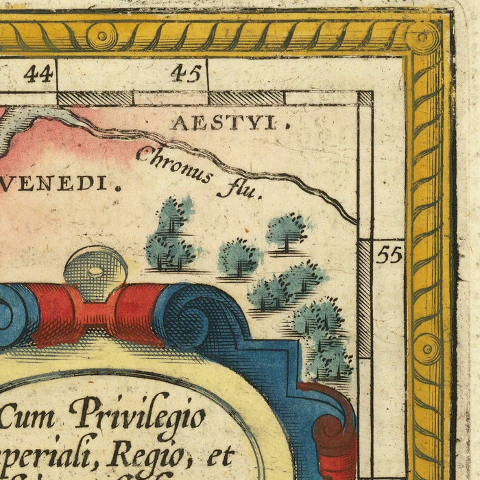
Ortelius’ attention to detail is evident in the map’s ornate design, featuring four intricately crafted strapwork cartouches. These embellishments not only enhance the visual appeal but also provide valuable information, such as the map’s title, date, and a dedication to Ortelius’ friend, Iacob Monavius. The cartouches, with their three-dimensional texture and shading, reflect the artistic flair and meticulous craftsmanship that define Ortelius’ work.
Prominent cities such as Augusta Treverorum (Trier), Mogontiacum (Mainz), and Colonia Agrippina (Cologne) are depicted with clusters of buildings, offering a glimpse into the urban landscape of ancient times. The map also highlights key regions and natural features, from the Oceanus Germanicus (North Sea) to the Hadriatici Sinus (Adriatic Sea), inviting viewers to explore the diverse terrains and rich history of central Europe.
The "Germaniae Veteris Typus" is more than just a map; it is a historical document that blends Ortelius’ cartographic skill with his passion for the classics. As part of the Parergon, the first historical atlas, this map stands as a significant achievement in the world of cartography, offering collectors and history enthusiasts a unique opportunity to own a piece of the past.
Cities and towns on this map
- Germany:
- Augusta Treverorum (Trier)
- Mogontiacum (Mainz)
-
Colonia Agrippina (Cologne)
-
France:
-
Argentoratum (Strasbourg)
-
Italy:
- Mediolanum (Milan)
Notable Features & Landmarks
- Bodies of Water:
- Oceanus Germanicus (North Sea)
- Hadriatici Sinus (Adriatic Sea)
- Rhine (Rhenus) River
-
Danube (Danubius) River
-
Mountains:
-
Various mountain ranges depicted in the center and south.
-
Cartouches:
-
Four ornate cartouches providing title, date, dedication, and a list of uncertain locations.
-
Forests:
- Extensive forested areas throughout the map.
Historical and design context
- Mapmaker/Publisher: Abraham Ortelius, creator of the first modern atlas, Theatrum Orbis Terrarum.
- Date of creation: Originally drawn in 1587, published in 1624.
- Themes:
- Depicts ancient Germany and surrounding regions.
- Combines geography with classical history, using sources such as Pliny, Strabo, Ptolemy, Seneca, and Tacitus.
- Design/Style:
- Features intricate strapwork cartouches with three-dimensional texture and shading.
- Cities are depicted with clusters of buildings.
- Historical significance:
- Part of the Parergon, an atlas focused on the ancient world.
- Considered the first historical atlas and a supplement to the Theatrum Orbis Terrarum.
Please double check the images to make sure that a specific town or place is shown on this map. You can also get in touch and ask us to check the map for you.
This map looks great at every size, but I always recommend going for a larger size if you have space. That way you can easily make out all of the details.
This map looks amazing at sizes all the way up to 70in (180cm). If you are looking for a larger map, please get in touch.
The model in the listing images is holding the 16x20in (40x50cm) version of this map.
The fifth listing image shows an example of my map personalisation service.
If you’re looking for something slightly different, check out my collection of the best old maps to see if something else catches your eye.
Please contact me to check if a certain location, landmark or feature is shown on this map.
This would make a wonderful birthday, Christmas, Father's Day, work leaving, anniversary or housewarming gift for someone from the areas covered by this map.
This map is available as a giclée print on acid free archival matte paper, or you can buy it framed. The frame is a nice, simple black frame that suits most aesthetics. Please get in touch if you'd like a different frame colour or material. My frames are glazed with super-clear museum-grade acrylic (perspex/acrylite), which is significantly less reflective than glass, safer, and will always arrive in perfect condition.
Share