The Unique Maps Co.
Old Map of Greece & Ionian Isles by Tallis, 1851: Athens, Mt. Olympus, Temple of Jupiter, Aegean
Old Map of Greece & Ionian Isles by Tallis, 1851: Athens, Mt. Olympus, Temple of Jupiter, Aegean
Couldn't load pickup availability
Step into the rich tapestry of 19th-century cartography with "Ionian Isles and Greece," a masterful creation by the esteemed John Tallis in 1851. This map is a stunning representation of Greece and the Ionian Isles during a pivotal moment in history, capturing the intricate dance of emerging nation-states and colonial influences. The Ionian Isles, shaded in pink, reflect their unique colonial past under British jurisdiction, while the mainland of Greece is etched with the echoes of its recent independence from the Ottoman Empire. Tallis's map not only delineates geographical boundaries but also serves as a visual narrative of a region in transformation.
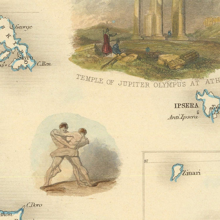
John Tallis, a luminary in the world of decorative cartography, brings his signature style to this map, intertwining artistic elegance with precise geographical detail. Known for his work with R. Montgomery Martin's Illustrated Atlas, Tallis's maps are celebrated for their aesthetic appeal and historical depth. His depiction of Greece and the Ionian Isles is no exception, featuring evocative vignettes that offer glimpses into the cultural and historical essence of the region. From ancient war chariots to scenes of Greek Corsairs navigating near Corfu, each illustration enriches the viewer's understanding of the area's vibrant past.
The map's geographical scope is both broad and detailed, encompassing the rugged landscapes of Greece, the serene Ionian Sea, and the majestic Aegean Sea. It captures the grandeur of Mt. Olympus, home to the legendary Temple of Jupiter, and the strategic borders with Turkey, reflecting the lingering shadows of Ottoman influence. The Ionian Isles, with their Venetian appellations like Corfu and Santa Maura, add another layer of historical intrigue, showcasing the blend of cultures that have shaped this region over centuries.
In addition to its geographical features, the map highlights key cities and towns that were central to Greece's historical narrative. From the bustling streets of Athens to the coastal charm of Patras and the ancient allure of Sparta, each settlement is a testament to Greece's enduring legacy. The map also provides a window into the Ionian Isles, with Corfu and Zakynthos standing out as jewels of the Mediterranean, each with its own unique story to tell.
This map is not just a geographical tool but a work of art that encapsulates the spirit of a region at a crossroads of history. It invites the viewer to explore the rich cultural tapestry of Greece and the Ionian Isles, offering a timeless glimpse into a world where ancient traditions and modern aspirations converge. With its blend of historical significance and artistic beauty, "Ionian Isles and Greece" by John Tallis is a treasure for collectors and history enthusiasts alike.
Cities and towns on this map
- Greece:
- Athens
- Patras
- Larissa
- Kalamata
- Volos
- Corinth
- Sparta
- Tripoli
- Argos
-
Nafplion
-
Ionian Isles:
- Corfu
- Zakynthos
- Lefkada
- Kefalonia
- Ithaca
- Paxos
Notable Features & Landmarks
- Illustrations:
- Ancient war chariot
- Temple of Jupiter on Mt. Olympus
- Greek Corsairs near Corfu
- Contemporary Greek figure
-
Scene of wrestlers
-
Landmarks:
-
Temple of Jupiter
-
Bodies of Water:
- Ionian Sea
-
Aegean Sea
-
Mountains:
-
Mt. Olympus
-
Borders:
- Greece's northern border with Turkey
Historical and design context
- Mapmaker/Publisher: John Tallis
-
Known for decorative cartography and association with R. Montgomery Martin's Illustrated Atlas.
-
Themes and Topics:
- Geopolitical Boundaries: Post-Ottoman influence and British jurisdiction over Ionian Isles.
-
Cultural Depictions: Vignettes of ancient and contemporary Greek scenes.
-
Design and Style:
- Decorative cartography with detailed vignettes.
-
Combines topographical information with cultural and historical imagery.
-
Historical Significance:
- Reflects Greece's post-independence boundary and colonial influences.
- Part of the Victorian era's global cartographic and exploration narrative.
Please double check the images to make sure that a specific town or place is shown on this map. You can also get in touch and ask us to check the map for you.
This map looks great at every size, but I always recommend going for a larger size if you have space. That way you can easily make out all of the details.
This map looks amazing at sizes all the way up to 50in (125cm). If you are looking for a larger map, please get in touch.
The model in the listing images is holding the 18x24in (45x60cm) version of this map.
The fifth listing image shows an example of my map personalisation service.
If you’re looking for something slightly different, check out my collection of the best old maps to see if something else catches your eye.
Please contact me to check if a certain location, landmark or feature is shown on this map.
This would make a wonderful birthday, Christmas, Father's Day, work leaving, anniversary or housewarming gift for someone from the areas covered by this map.
This map is available as a giclée print on acid free archival matte paper, or you can buy it framed. The frame is a nice, simple black frame that suits most aesthetics. Please get in touch if you'd like a different frame colour or material. My frames are glazed with super-clear museum-grade acrylic (perspex/acrylite), which is significantly less reflective than glass, safer, and will always arrive in perfect condition.
Share