The Unique Maps Co.
Old Map of Solvang, California by USGS, 1959 – Buellton, Santa Ynez & Los Olivos
Old Map of Solvang, California by USGS, 1959 – Buellton, Santa Ynez & Los Olivos
Couldn't load pickup availability
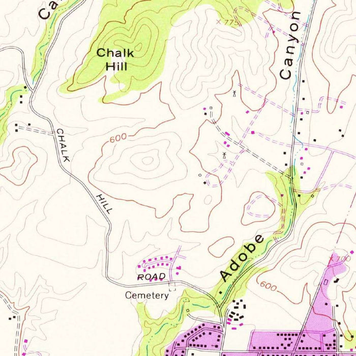
Titled “Solvang,” this US Geological Survey topographical map presents California’s Santa Ynez Valley as recorded from 1959 survey data and issued with a 1977 imprint. At a 1:24,000 scale, it captures the town of Solvang and its neighboring landscape with the precision characteristic of mid-century USGS mapping. The map fixes a moment in the region’s history before later waves of development, tourism infrastructure, and suburban expansion further reshaped the valley. Solvang appears amid a network of roads, waterways, agricultural lands, and rising hills, offering a detailed view of how the Danish-influenced town sat within the broader geography of Santa Barbara County. Its historical value lies not only in what it names, but in how it reveals the relationship between settlement, terrain, and transportation.
The US Geological Survey brought to this map the disciplined visual language that made its quadrangles indispensable to engineers, planners, hikers, geologists, and historians. Contour lines articulate the hilly ground around Solvang with quiet authority, translating ridgelines, slopes, ravines, and valley floors into an elegant system of measured elevation. Green shading marks vegetated areas, while yellow indicates more open or sparsely covered land, creating a readable portrait of both natural cover and human-modified terrain. Roads, trails, streams, and cultural features are layered into the design without overwhelming it. The result is a map that is both practical and visually refined, a study in cartographic restraint where every symbol serves a clear geographic purpose.
Solvang itself sits at the heart of a distinctive cultural and physical landscape. Founded in 1911 by Danish immigrants, the town became known for its Northern European architectural character, bakeries, inns, and civic identity, all set within a quintessentially Californian valley. Nearby Santa Ynez, Los Olivos, and Buellton form a chain of settlements linked by roads, ranchlands, and the Santa Ynez River system. The map shows this network before the region’s later prominence as a wine-country destination had fully matured. In its roads and place names, one can sense a working landscape of farms, ranches, mission history, and small-town commerce, still closely tied to the contours of the valley and the routes that connected it to the coast and interior.
The surrounding geography gives the map much of its drama. The Santa Ynez River and local drainages cut through the valley, while the surrounding hills rise in closely spaced contours that show the transition from inhabited lowlands to rugged uplands. Features such as Alisal Lake, the Arroyo Hondo River, Zaca Lake, and the approaches toward Los Padres National Forest evoke a region where water, oak woodland, chaparral, and steep terrain shape movement and settlement. To the south and west, routes toward Gaviota Pass and the coastal corridor hint at the valley’s strategic position between the Pacific shore and inland California. Highway 101, one of the state’s great transportation arteries, appears as a defining modern line through an older pastoral landscape.
As a historical document, this map is especially evocative for what it preserves about land use and access in the late twentieth century. Trails, minor roads, and named natural features reveal patterns of travel that served ranching, recreation, forestry, and local communities. The proximity of Refugio State Park, Camino Cielo, the San Rafael Wilderness Area, and Los Padres National Forest places Solvang within a wider setting of protected lands and mountainous backcountry. Since the original survey, the Santa Ynez Valley has become increasingly associated with tourism, vineyards, and residential growth, making this map a valuable benchmark for comparison. It records a landscape poised between rural continuity and modern transformation, rendered with the measured clarity of classic USGS topography.
Cities, towns and places on this map
- Solvang
- Buellton
- Los Olivos
- Santa Ynez
- Lompoc
- Vandenberg Village
- Gaviota Pass
- Refugio State Park
- Los Padres National Forest
- Camino Cielo
- Alisal Lake
- Arroyo Hondo River
- Zaca Lake
- San Rafael Wilderness Area
- Highway 101
- Various roads and trails in the region
- Santa Ynez River
Historical context & cartographic details
- Historical 1:24,000 topographical map depicting Solvang, California, and surrounding areas.
- Based on survey data from 1959, with a 1977 imprint.
- Produced by the US Geological Survey, known for accurate and detailed mapping for geological studies and earth science data.
- Uses a clear color scheme, including shades of green for vegetation and yellow for areas without significant vegetation.
- Contour lines show elevation changes and illustrate the hilly terrain surrounding Solvang.
- Different hues indicate various landforms and help distinguish landscape features.
- Provides a historical reference to the topography and layout of Solvang before significant modern development.
Looking for a particular place? Review the detailed images to confirm that the town, landmark or feature you have in mind appears on the map. If you are unsure, ask our workshop to check before you order.
Detailed maps are especially rewarding at larger sizes, where names, boundaries and decorative features have more room to be appreciated. Use the close-up preview and size guide to choose the right scale for your wall.
This map looks amazing at sizes all the way up to 50in (125cm). If you are looking for a larger map, please get in touch.
The model in the listing images is holding the 16x20in (40x50cm) version of this map.
Where personalisation is available, you can add a short title or dedication, mark one meaningful place, or request one considered visual detail. See personalised map examples.
Every piece is printed to museum-grade archival standards using fade-resistant pigment inks on acid-free matte paper. Choose an unframed map print, framed map or canvas using the finish options above. Framed maps use crystal-clear optical acrylic and arrive ready to hang.
With its rich detail and strong sense of place, this map makes a considered gift for a new home, anniversary, retirement or anyone with a personal connection to the area shown. Still deciding? Explore our collection of rare old and vintage maps to discover another place, period or style.
Share