The Unique Maps Co.
Old Military Map of Lisbon, 1814: Jerónimos, Castelo de S. Jorge, Praça do Commercio, Tagus River
Old Military Map of Lisbon, 1814: Jerónimos, Castelo de S. Jorge, Praça do Commercio, Tagus River
Couldn't load pickup availability
The "Mapa da Cidade de Lisboa e de Belem em 1812" is a captivating historical artifact that offers a window into Lisbon's storied past. Crafted in 1814 by John Tomkyns, a former captain in the Royal Dragoons, this map reflects the intricate details of Lisbon and Belém during the Peninsular War. It showcases the city's transformation following the catastrophic 1755 earthquake and tsunami, highlighting the orderly blocks near the Praça do Commercio and the medieval street structure to the east. The map is not only a testament to Tomkyns' cartographic skill but also a tribute to the Duke of Wellington, under whose command he served.
This map beautifully captures the vibrant neighborhoods of Lisbon, such as the bustling Praça do Commercio area, which stands as a symbol of the city's resilience and renewal. The intricate hachures depict the hilly terrain surrounding Lisbon, offering a detailed view of the landscape that played a significant role during the Napoleonic Wars. The inclusion of Belém, with its rich maritime history, adds another layer of intrigue, showcasing areas like the Jerónimos Monastery, a UNESCO World Heritage Site and a beacon for sailors bound for the Americas.
Landmarks such as the Castelo de S. Jorge, perched on a hilltop, provide a strategic vantage point over the city, reflecting Lisbon's defensive importance. The map also features a compass rose and the coat of arms of the Portuguese monarchy, underscoring the city's historical and political significance. These elements, combined with a detailed table of significant buildings, make this map an invaluable resource for understanding Lisbon's urban and cultural landscape during a pivotal moment in history.
The Tagus River, flowing gracefully along the map's southern edge, serves as a lifeline for the city, linking Lisbon to the broader world. This river, a vital artery for trade and exploration, is depicted with a double scale bar, emphasizing its navigational importance. The map also highlights the strategic Lines of Torres Vedras, a series of fortifications that protected Lisbon from French advances, showcasing the city's role as a fortress of resistance during the Peninsular War.
John Tomkyns' creation is more than just a map; it is a narrative of Lisbon's resilience and strategic importance during a time of conflict. The map's historical context, combined with its detailed depiction of neighborhoods, landmarks, and geographical features, makes it a compelling addition to any collection. It serves as a tribute to the enduring spirit of Lisbon and the strategic genius of the Duke of Wellington, offering a rich tapestry of history and cartography that continues to captivate and inspire.
Streets and roads on this map
- Calçada da Estrela
- Calçada do Combro
- Calçada do Monte
- Calçada do Salitre
- Calçada dos Caetanos
- Estrada de Benfica
- Estrada de Chelas
- Estrada de Sacavém
- Estrada do Arco do Cego
- Estrada do Lumiar
- Estrada do Poço do Bispo
- Estrada dos Prazeres
- Largo das Duas Igrejas
- Largo do Carmo
- Largo do Conde Barão
- Largo do Intendente
- Largo do Rato
- Largo do Rossio
- Rua da Alfândega
- Rua da Artilharia
- Rua da Assunção
- Rua da Betesga
- Rua da Boavista
- Rua da Esperança
- Rua da Madalena
- Rua da Prata
- Rua das Flores
- Rua das Portas de Santo Antão
- Rua de São Bento
Notable Features & Landmarks
- Jerónimos Monastery
- Castelo de S. Jorge
- Compass rose
- Coat of arms of the Portuguese monarchy
- Praça do Commercio area
- Double scale bar
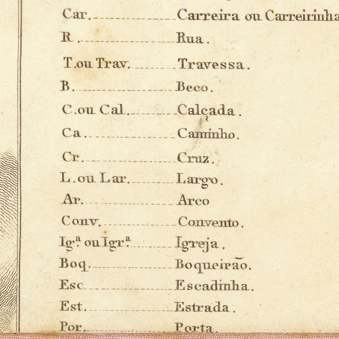
- Table of significant buildings
Historical and design context
- Name of the map: Mapa da Cidade de Lisboa e de Belem em 1812.
- Date made: 1814.
- Mapmaker/Publisher: John Tomkyns, a former captain in the Royal Dragoons.
- Historical context: Created during the Peninsular War, part of the Napoleonic Wars.
- Themes:
- Political and physical features: Detailed topography of Lisbon and Belém.
- Military significance: Drawn by an officer under the Duke of Wellington.
- Reconstruction: Shows Lisbon post-1755 earthquake and tsunami.
- Regions shown: Lisbon and Belém, Portugal.
- Design style:
- Hachures: Used to depict hilly terrain.
- Cartouche: Lists Wellington's titles.
- Historical significance: Reflects military observations and homage to Wellington.
Please double check the images to make sure that a specific town or place is shown on this map. You can also get in touch and ask us to check the map for you.
This map looks great at every size, but I always recommend going for a larger size if you have space. That way you can easily make out all of the details.
This map looks amazing at sizes all the way up to 100in (250cm). If you are looking for a larger map, please get in touch.
Please note: the labels on this map are hard to read if you order a map that is 20in (50cm) or smaller. The map is still very attractive, but if you would like to read the map easily, please buy a larger size.
The model in the listing images is holding the 24x36in (60x90cm) version of this map.
The fifth listing image shows an example of my map personalisation service.
If you’re looking for something slightly different, check out my collection of the best old maps to see if something else catches your eye.
Please contact me to check if a certain location, landmark or feature is shown on this map.
This would make a wonderful birthday, Christmas, Father's Day, work leaving, anniversary or housewarming gift for someone from the areas covered by this map.
This map is available as a giclée print on acid free archival matte paper, or you can buy it framed. The frame is a nice, simple black frame that suits most aesthetics. Please get in touch if you'd like a different frame colour or material. My frames are glazed with super-clear museum-grade acrylic (perspex/acrylite), which is significantly less reflective than glass, safer, and will always arrive in perfect condition.
Share